Network Industries Quarterly has been published four times a year since 2008. One of its special issues focuses on digitalising infrastructure. This special issue includes also the paper written by the representatives of Åbo Akademi University (Finland). Åbo Akademi University is a partner of project Baltic Loop and leads working package ‘Business models for smart and sustainable sea’.
Tsvetkova, Gustafsson and Wikström identify how digitalisation is transforming the infrastructure of ports and how, as a result, port managers are under growing pressure to provide prompt service.
A little insight into the article:
Highly fragmented industries characterized by extreme information asymmetries are the first to be affected by the ‘platform revolution’ (Sarkar 2016). In that respect, sea logistics is a sector in need of improved efficiency (Gustafsson et al.2015). The digital transformation, coupled with a transition to platform economy, have the potential to facilitate just such a change. One of the main effects of digital platforms in this transformation is the shift towards multi-sided markets and the facilitation of network effects. (..)
The increasing volumes of data generated regarding maritime transport creates opportunities for the appearance and growth of new business models and the ‘port as a service’ types of platforms. Incumbent actors such as the port authorities have a choice to either proactively use the enabling technologies to reinvent their own business models or they risk having their value proposition commoditized in the fourth industrial revolution. In this paper, we review the recent digital developments related to ports and discuss their effects on the transformation of sea logistics and, in particular, on port operations.
>> This article is funded by the project Baltic Loop.
The Baltic Sea Commission is an international, independent organisation of Regional Authorities at subnational level in the Baltic Sea region. We are honored for the interest about shown by them regarding the Baltic Loop project. Two representatives of the partnership – project manager Irina Wahlström at Åbo Akademi and project manager Ahmed Alaeddine at Region Örebro County were questioned and you can read the interview in the CPMR Baltic Sea Commission Newsflash (October 2020).
In the project, we have already been able to identify certain bottlenecks such as high traffic volume in relation to existing infrastructure capacity in the Oslo-Stockholm route, long queues at the borders between Estonia-Latvia and Latvia-Russia. There are also bottlenecks at the ports in the Baltic Sea area, where they are increasingly forced to adapt their operations and geographical scope in relation to growing large cities, where the consequence is that port areas have less land available, says Ahmed Alaeddine (Region Örebro County).
The planning and implementation of well-functioning traffic/transport systems is a complex and multilayered process covering many measures and elimination of transport hindrances and bottlenecks.
It affects many actors and sectors (users, planners, authorities and administrations) of the society on all levels. Thus, the process needs to involve and encourage all stakeholders, to a greater extent, to develop more open and transparent communication, better cooperation and a stronger commitment to establish a coordinated, long-term vision and holistic approach to transport system planning, says project manager Irina Wahlström at Åbo Akademi.
This time we invite you to read about the outcomes of the
survey in three transport corridors.
Qualitative data from interviews and surveys with
stakeholders have been collected – interesting information is expected to help
reduce barriers to the smooth flow of transport and save time spent on the way.
We also invite you to read about the latest activities in the project, because, despite the difficult conditions created by the situation with Covid-19, the work continues.
A field survey was conducted with real-time test drives to
check and detect bottlenecks in a particular transport corridor (Youtube
video). Work is also underway on the development of various planning documents,
as well as a number of face-to-face and online meetings and seminars.
Sometimes solving problems will require significant changes in the system, other times it is just necessary to come together and think creatively.
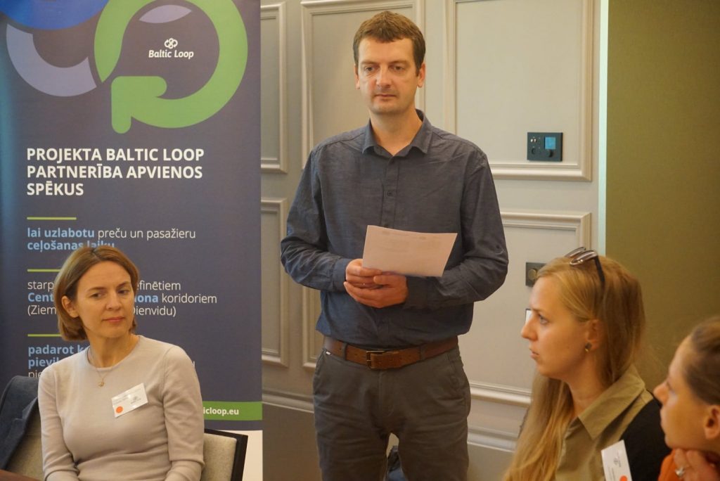
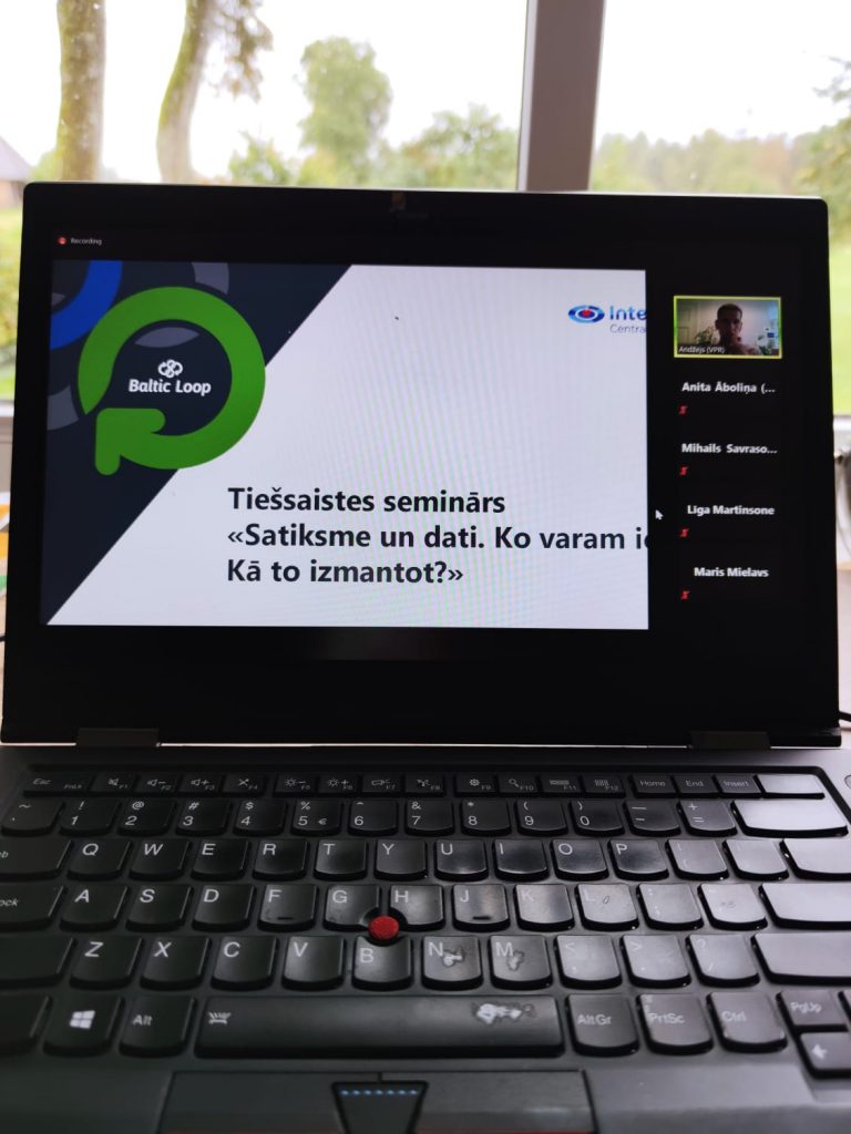
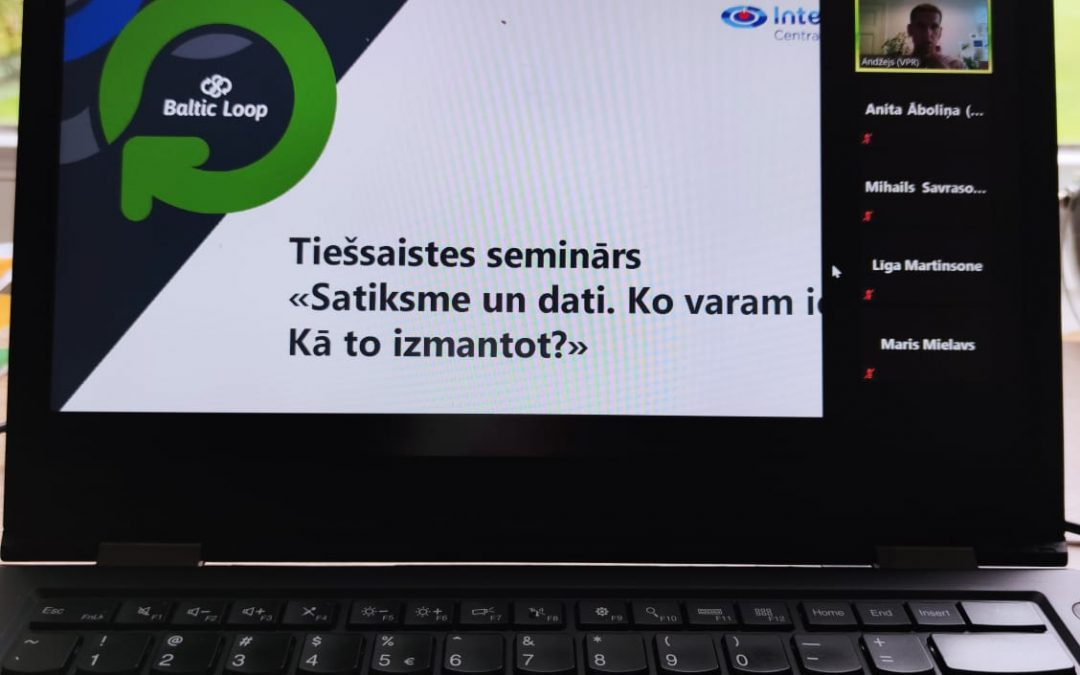
On September 15, Vidzeme Planning Region organized an online seminar “TRAFFIC AND DATA. What can we get? How to use it?” to update the importance of data in the development of the transport sector, as well as to outline how it is practically possible to obtain data, how to collect it, and how to use it meaningfully. The online workshop brought together around 50 participants who had the opportunity to hear the experiences of four knowledgeable industry professionals on the possibilities of using the data.
The seminar was organized within the framework of the Baltic Loop project.
It’s all about data available in a portable format
Mikus Jēkabsons (Public Services Department), a representative of the Ministry of Environmental Protection and Regional Development, emphasized that data is an increasingly important resource. He reminded once again what open data is and in what formats it can be found. The data is used by a very wide range of professionals, from journalists and researchers to entrepreneurs to develop new products and services, as well as to enable institutions to work more efficiently, including to save money. A broader insight into the opportunities provided by the open data portal data.gov.lv was provided. M. Jēkabsons has observed that both state institutions and local governments often lack an understanding of how to distinguish data (for example, local government budget by sectors) from information (for example, minutes of local government council meetings) and what is really open data (data in machine-readable format, provided to the public).
Decisions should not be based on intuition
Mihails Savrasovs (Faculty of Computer Science and Information Technology, Transport and Telecommunication Institute in Latvia) spoke about the possibilities of data modeling, revealing how to make better use of data, in what levels of detail they can be viewed. “Modeling is a powerful tool that allows you to analyze complex systems and make data-based decisions,” Savrasov said, calling for intuition-free decisions. M.Savrasov has also concluded that modeling is only a tool because everything is based on data and their level of detail. This is one of the problems that prevent the full potential of the data from being realized. Continuing, the expert pointed out the paradox – although information and communication technologies are constantly evolving and new data sets are available, but many of them are still not publicly available on the grounds of trade secrets or personal data protection regulation. This is a problem that needs to be addressed.
Missing data can also be generated by the population
Nika Aleksejeva from the association “Data School” briefly outlined the goals of the organization and told about the potential of citizen participation in creating new data that is currently missing for the industry. In order to get people to respond, it is important to be able to convince them that participation is not just formal, that it is followed by feedback – a positive stimulus, such as solving a problem identified by the citizen or sorting out an identified problem area. N. Aleksejeva told in more detail about the course of the previously implemented project “Bicycle Data”, within the framework of which the load of bicycle lanes in Riga was studied with the active involvement of the society. Currently, another project is being implemented – “Veloslazdi”, which, by involving cyclists, allows to identify the shortcomings of the bicycle infrastructure in the city. As of May 1, 2020, 950 bicycle traps have been reported. The problems are compiled and submitted to the Riga City Council Traffic Department for resolution, while volunteer enthusiasts later inspect the sites to see if the problem has been resolved. N. Aleksejeva points out: “Nowadays, technically anyone can implement this type of platform project. The question is: who will give the data, what will happen to the data afterwards, will the delivery of the data make sense, is the expected result clear and will there be feedback? ”
The data collected must be used to solve problems in the urban environment
Māris Mielavs, Head of Jelgava City Municipality Institution “Pilsētsaimniecība” and Māris Skudra, Head of Infrastructure Management Systems Division of “Pilsētsaimniecība” spoke about the opportunities that allow the development of modern cities, revealing how traffic data is obtained and used in Jelgava urban development planning. Seven types of data storage tools are used in the city of Jelgava. The various systems allow access to accurate data (eg traffic volume, intensity, speed, trajectories) at any time and place, successfully addressing the limited capacity of human resources and at the same time saving municipal funds. One example is a sensor built into the carriageway that, in response to a magnetic field generated by a car, provides information on the number of cars that are later used to model flow rates and optimize traffic light signaling to improve intersection permeability. Such activities need to be carried out, for example, at the start of a new school year, when significantly more vehicles appear on the streets in the morning and afternoon. Vehicle counting and classification equipment not only collects data but also helps to address safety issues, as it often helps to identify the causes of accidents, identify culprits and make infrastructure improvements when needed in a given situation to avoid future accidents. The attendees were especially interested in the meteorological stations installed in the city of Jelgava, which help to predict the possibility of black ice, allowing to plan the treatment of the road surface in time.
By the end of 2020, a vision for the development of the Via
Hanseatica tourism and transport corridor 2030 will be developed in the Vidzeme
planning region. The expected result is a spatial development planning document
that would help to improve the flow of passengers and tourists in the Vidzeme
planning region. This would not only identify potential solutions to improve
the region’s attractiveness in terms of mobility, but also make practical
proposals to reduce travel time and improve passenger access to the corridor
from the hinterland.
The document is intended to include recommendations, for
example, on how to optimize routes, how to improve the flow of information on
traffic routes, how to provide more convenient public transport connections,
etc. During the development of the plan, meetings with stakeholders interested
in the economic development of Vidzeme, ie representatives of state and
municipal institutions, entrepreneurs and tourism and transport experts, will
be organized to analyze the conditions hindering the smooth and convenient flow
of passengers in the corridor and receive suggestions on what improvements may
be needed to address the problem.
The final document is expected to be useful both for entrepreneurs and investors to make decisions on starting, improving or expanding a business, as well as for local governments in the region, which will be able to use the document when planning the development of their territories. The conclusions will also be binding on public administration institutions, such as the Ministry of Transport, the Ministry of Environmental Protection and Regional Development, and the Ministry of Economics, in carrying out work on the development and updating of national level development planning documents.
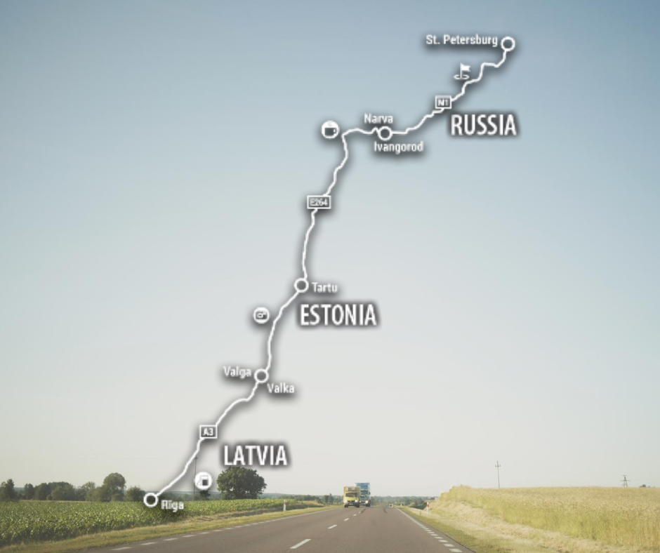
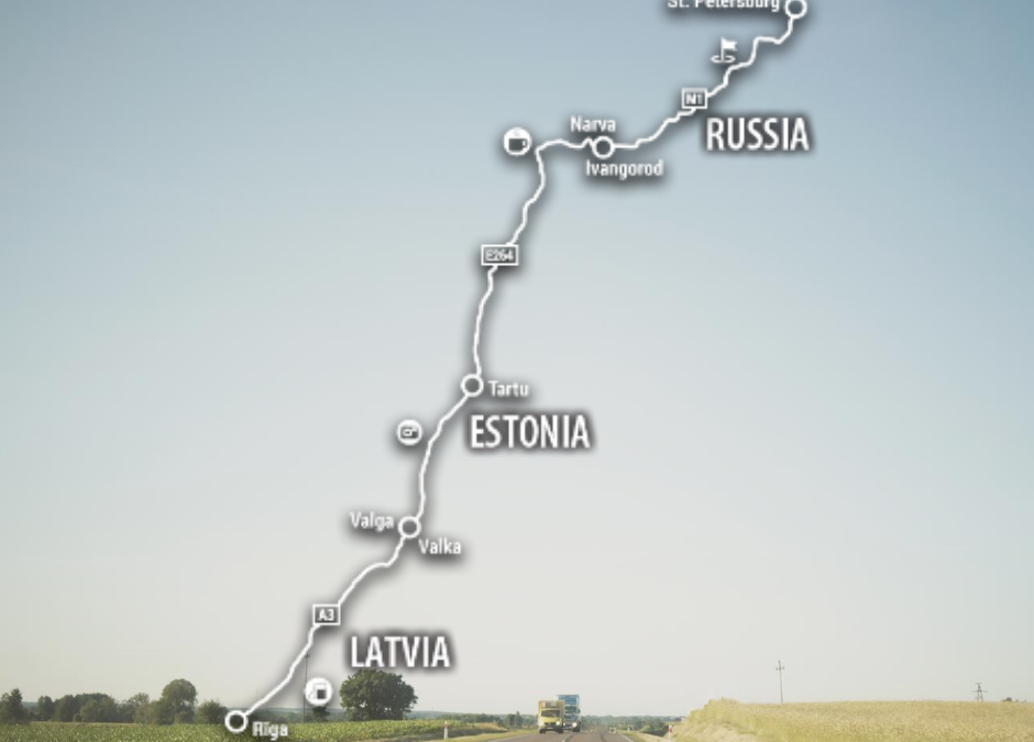
Via Hanseatica is a historically significant international transport, tourism,and trade corridor connecting the eastern part of the Baltic Sea region with the central regions of the European Union on the route Riga-Valmiera-Tartu-Narva-St. Petersburg.
This transport corridor and the adjacent territory serve as
an important tourism development corridor, but one of the limiting factors for
achieving its full potential is the availability and quality of transport
services. Both local and foreign tourists, when looking for an alternative mode
of transport to personal road transport, face the fragmentation of the proposed
transport solutions, lack of digitally available information, as well as
uncoordinated public transport times, which hinder convenient movement between
several tourist attractions near the corridor. Tourists also face various
obstacles when choosing personal transport, such as the quality of
infrastructure (condition of roads, lack of directions).
This website uses cookies so that we can provide you with the best user experience possible. Cookie information is stored in your browser and performs functions such as recognising you when you return to our website and helping our team to understand which sections of the website you find most interesting and useful.
Strictly Necessary Cookies
Strictly Necessary Cookie should be enabled at all times so that we can save your preferences for cookie settings.
If you disable this cookie, we will not be able to save your preferences. This means that every time you visit this website you will need to enable or disable cookies again.