The planning and implementation of well-functioning traffic/transport systems is a complex and multilayered process covering many measures and elimination of transport hindrances and bottlenecks. It affects many actors and sectors (users, planners, authorities and administrations) of the society on all levels. Thus, the process needs to involve and encourage all stakeholders, to a greater extent, to develop more open and transparent communication, better cooperation and a stronger commitment to establish a coordinated, long-term vision and holistic approach to transport system planning.
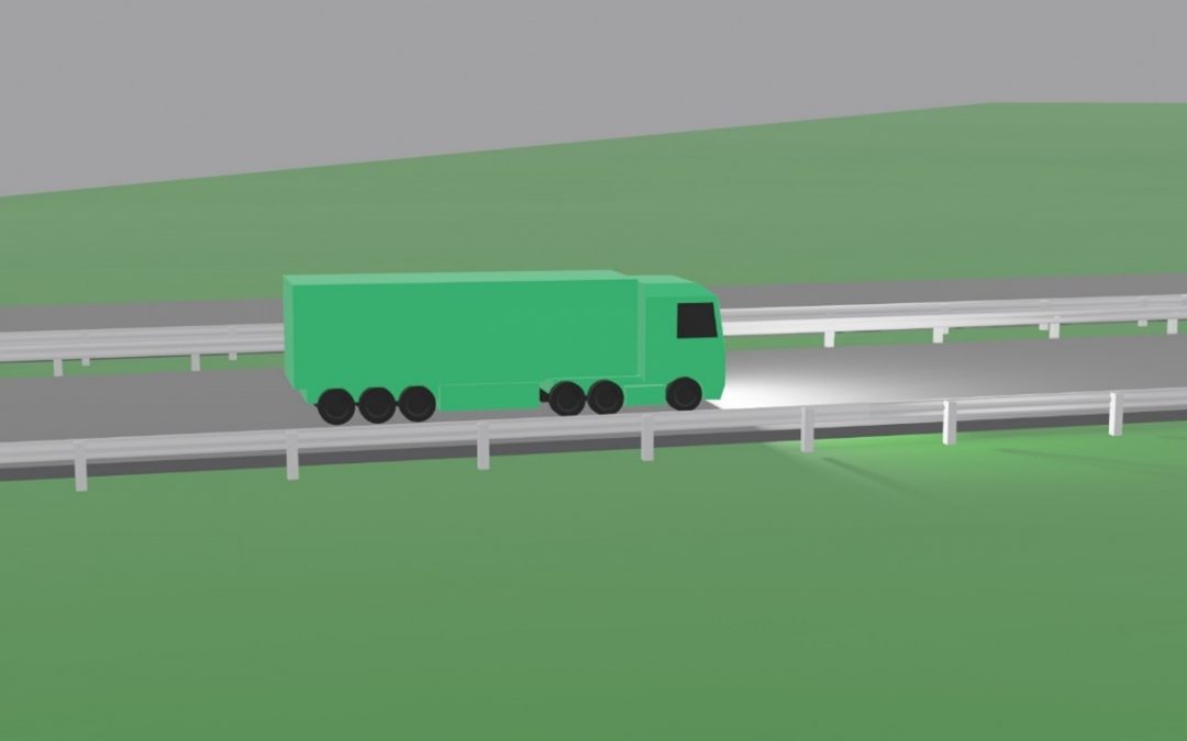
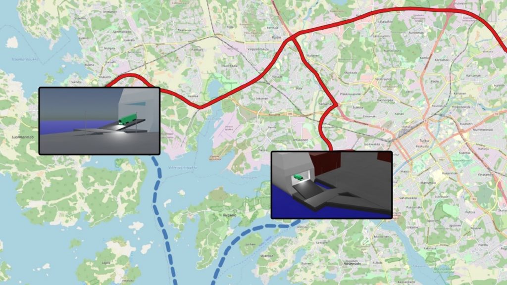
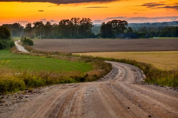
Continuing the project, TUAS from Finland intends to visualize the southern corridor by animating the entire route from the Turku port to the Russian border (Vaalimaa) to clearly show cargo traffic bottlenecks that are closely related to the time spent on the road, as well as other characteristics. The visualization will conclude several topics emerged during the project like bottlenecks, total travel time, total distance, total production of carbon dioxide emissions, as well as possible time saving without bottlenecks and possible reduced carbon dioxide emissions. The visualization will clearly indicate the specific problem areas in the corridor. With the knowledge of bottlenecks and different indicators, there will be a full understanding, what kind and why some challenges have occurred in the corridor. When all possible bottlenecks will be removed, potential time savings will be highlighted to emphasize the potential benefits if the problem points were addressed. The video is currently being created and it will be available for everyone to watch.
The main task of the visualizer is to present the data in a clear and informative way. An example of visualization is a map, which contains very versatile information that can be displayed in one place in a convenient and easy-to-understand way. The information can be in numeric format, as a report, or anything else. Traffic visualizations can help researchers and others interested in understanding the situation relatively quickly – they can reflect characteristics such as traffic density, cargo movement or locations of bottlenecks on the map. This has a significant advantage to authors, researchers and other third-party members to have a fully presented detailed view of the topics. One of the most important part in the visualizations are the results which are comparable to each other. This is a powerful tool to observe different situations in wide perspective. This method has been used also in several Baltic Loop visualizations.
On January 7, 2021, Vidzeme Planning Region organized a stakeholder meeting to continue the discussion on the vision of the development of the tourism and transport corridor on the Via Hansetica route until 2030. Representatives of the tourism and transport sectors agreed on three strategic development goals for the Via Hanseatica tourism corridor: 1) to improve the speed and efficiency of traffic flow; 2) to develop tourism and mobility information systems; 3) to increase the flow of tourists in the Via Hanseatica tourist corridor. Last December, invited participants met online to discuss a summary of the current situation and to provide ideas for refining and complementing the strategy’s objectives and actions. At the beginning of 2021, industry representatives were gathered to comment on the strategic part of the document.
The strategic part of the draft document formulates the long-term development vision of the tourist route Via Hanseatica for the improvement of passenger flow, strategic goals and development priorities. In addition, directions for action and long-term actions to achieve the strategic goals are outlined.
Given that the quality of the traffic system is crucial for the economic development of the area, the participants of the meeting agreed that the area needs traffic improvements in order to be able to compete at the national and international level. Significant changes can be made by improving both the transport infrastructure and the quality of public transport services, including a strong focus on convenient connections. It is important to be able to use different modes of transport, i.e. for the first and last mile, balancing the offer and possibilities of traditional and relatively new mobility solutions in the area of influence of the Via Hanseatica.
It should be noted that the necessary improvements are important for both visitors and residents of the territory – therefore an integrated approach has been used in defining goals and actions, ensuring high quality of services for both interconnected user groups in the long run.
We remind you that the aim of developing the strategic document is to find out the necessary improvements of transport infrastructure, services and information to ensure more convenient and efficient flow of passengers (mainly tourists) on the Via Hanseatica tourist route, promoting tourism development in Vidzeme planning region.
The vision for the development of the Via Hanseatica tourism route has been developed on the basis of an analysis of the current situation, in which transport industry experts, tourism industry experts and entrepreneurs, representatives of Via Hanseatica municipalities, as well as passenger carriers were interviewed. Passenger and tourist flows were also analyzed, the condition of infrastructure and the quality of services were assessed.
The document, which soon will be completed, will serve as guidelines for the development of the specific territory, and it will be used in their work by municipal specialists, for example, when working with territorial development planning documents, and entrepreneurs planning new services in the territory of Via Hanseatica.
It’s time to stop and see how much work has been done! We invite you to get acquainted with the fifth news page of the project! Continuing to work closely with stakeholders, we have compiled a number of key challenges as well as recommendations on how to address them. Project experts and specialists have an excellent amount of rich information to arrive at a qualitative and feasible result.
In order to fully understand the situation, in-depth interviews with stakeholders in the development of the tourism and transport corridor were conducted during the study on the development of the Tourism and Transport Corridor Development Vision 2030 on the Via Hanseatica, which is a section of the Baltic Loop Southern Transport Corridor.
Within the framework of the study, the authors conducted in-depth interviews with four types of stakeholders: transport industry experts, tourism industry experts and entrepreneurs, representatives of Vidzeme planning region municipalities and passenger public transport companies (road and rail transport).
The purpose of the in-depth interviews was to find out the answers to the following questions:
a) The main restrictions (technical, administrative, legal, economic, etc.) on the efficient flow of passengers on the VIA Hanseatica route.
b) Necessary improvements for better and more efficient transport infrastructure and services on the VIA Hanseatica tourist route, including mitigation of negative impacts on the environment and climate change.
c) Possible future challenges and risks for the development of transport flow (including tourist flow) on the tourist route VIA Hanseatica and in the main transport flow corridors of the Vidzeme planning region (roads A2, A3 and railway).
Within the framework of the research, 27 participants were invited to interviews, and finally 17 interviews took place – 15 of them on the Zoom platform online, one – by phone, one – by e-mail.
The talks provided valuable observations and conclusions, often including suggestions on how to solve problems that hinder the proper organization of traffic flow, such as:
Prioritizing of investments is a challenge. What are the priorities in post-Covid-19 period? Should we invest more in freight? In public transport? And if yes in what kind of public transport? For tourism or transport corridors the question is similar – do we invest in better roads or in better railways? In case of VIA Hanseatica it is not part of any cornet web or corridor, it will be very difficult to convince that investment in this corridor is of high importance for national decision makers. Making new corridors or connecting to the existing corridors?
Wiktor Szydarowski, PhD, ESPON EGTC, Director, transport policy expert
The Polish experience has shown that building faster roads and thinking less about exits has broken down areas that affect local people, businesses – the faster the connections, the more advantageous the larger centers and the less advantageous the places in the middle.
Liene Gaujeniete, Spatial Planning Expert, VASAB (Visions & strategies around the Baltic sea)
High costs and relatively low potential economic benefits are the main limitations for infrastructure development, however, it is very important to raise Latvia’s position in cycling tourism.
Elmārs Daniševskis, engineer and traffic infrastructure planner, member of the Latvian Association of Transport Engineers.
It is difficult to get to atypical tourist destinations – public transport goes once a day or less, so other solutions must be sought. In addition, there is no centralized way to buy a ticket for both a bus or a train. The main risks and challenges are related to the increasing congestion of roads and their condition, and train wagons are also old.
Mārtiņš Malcenieks, Deputy of Cēsis County Council, Active tourism centre Eži Ltd.
At present, tourists who have come to Latvia often have to evaluate the information, not with which it would be more convenient to get to the destination, but how and whether it is possible to get there by public transport. There is no flexible system to change routes quickly. I consider the decision-making process to be very long, and the route network is managed centrally from Riga.
Ivo Ošenieks, President of the Latvian Passenger Carriers Association
Public transport runs on specific roads and at specific times – it aims to meet the needs of the population, so the needs of tourists are secondary and adaptable. The A2 and A3 roads are in good condition, but the number of users is growing, they are congested, and congestion is occurring in particularly good weather conditions, which means that there is insufficient road capacity. Paved roads need to be improved; asphalt roads need more capacity. There are bureaucratic constraints on flexible route planning. Multimodal connections and transfer points are needed – improvements are needed to run fewer buses with more passengers than half-empty buses.
Lotārs Dravants, Head of Passenger Transport Service in CATA Corp.
MAIN CONCLUSIONS
Interviews with representatives of various fields revealed such aspects as the lack of information about the competencies, plans and possibilities of other sectors to change the existing procedures.
The opinions of the interviewees will be invaluable in the development of the strategic part of the document and the action plan – the experts expressed ideas about the vision and functioning of the VIA Hanseatica tourism route in perspective.
The main risk in the use of the country’s regional and local roads is their current condition and planned improvement measures. For the most part, interviewees agreed that the country’s main roads, A2 and A3, were in good condition, but expressed concerns about their capacity for fast movement and safety aspects due to high traffic volumes.
The interviewees agreed on the need to improve digital information systems – the possibilities of route planning by public transport, bicycles are currently limited. The opinion on the establishment of a unified public transport ticket purchase system has been expressed several times.
Interviewees agreed on the potential for rail use and the current state of inadequate infrastructure, in particular trains.
Most of the interviewees believe that foreign tourists would like to use public transport services, especially railways, but there is a need to significantly improve the availability (schedule) and quality of services (shorter travel time and better service).
Experts expressed the need to promote the use of public transport services in the largest centers of the tourist region.
This website uses cookies so that we can provide you with the best user experience possible. Cookie information is stored in your browser and performs functions such as recognising you when you return to our website and helping our team to understand which sections of the website you find most interesting and useful.
Strictly Necessary Cookies
Strictly Necessary Cookie should be enabled at all times so that we can save your preferences for cookie settings.
If you disable this cookie, we will not be able to save your preferences. This means that every time you visit this website you will need to enable or disable cookies again.