The planning and implementation of well-functioning traffic/transport systems is a complex and multilayered process covering many measures and elimination of transport hindrances and bottlenecks. It affects many actors and sectors (users, planners, authorities and administrations) of the society on all levels. Thus, the process needs to involve and encourage all stakeholders, to a greater extent, to develop more open and transparent communication, better cooperation and a stronger commitment to establish a coordinated, long-term vision and holistic approach to transport system planning.
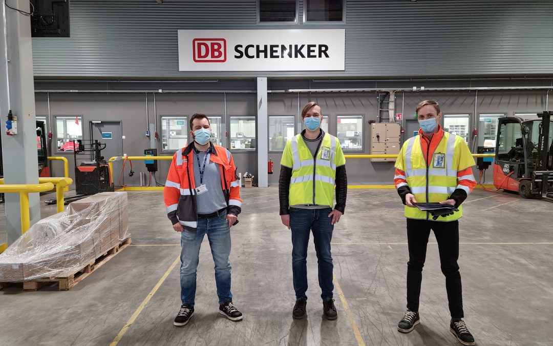
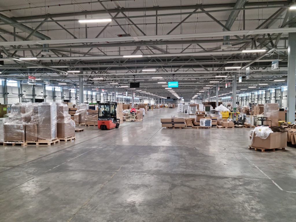
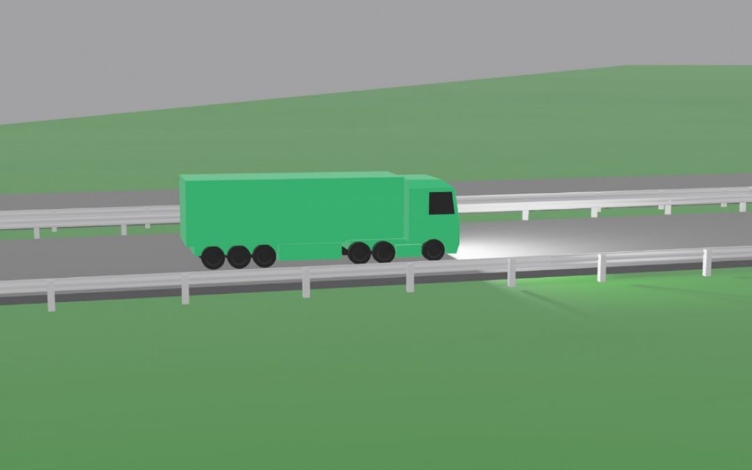
Following the set goal, the DB Schenker terminal has been chosen as the pilot site, where, using various methodologies, proposals will be made for actions to be taken to speed up the cargo handling in the terminal. It is located at Turku Ring Road along the E-18 corridor. The study will use new tools and methods developed by private company Noccela Ltd., that provided significant data for the Turku University of Applied Science (TUAS) project team. This company has been developing new ICT-based solutions to track the time-location positions of cargo. The idea is based on tags that are placed to forklift trucks going around or placed to cargo being transferred at the terminal. The obtained data will allow TUAS to analyze the situation and continue work on practical solutions to optimize cargo handling inside the terminal. Part of the terminal’s operations are considered to be part of the bottlenecks in the Northern Corridor, therefore the results collected here will complete the whole picture about the bottlenecks and hindrances along the corridor.
Terminals need a redesign concerning the present network. There is a clear need for re-establish the terminal network -not only because of more fluent traffic and logistic -but also for better air quality and noise reduction.
From Baltic LOOp project application
From left: Timo Päivärinta, Head of terminal.
Tomi Leppänen, an engineering student at TUAS, doing interviews and observations.
Akseli Väisänen, master student at TUAS, leading observations and analyzing data offered by Noccela
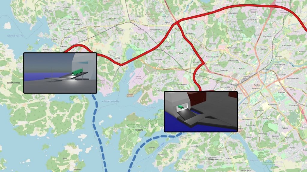
Continuing the project, TUAS from Finland intends to visualize the southern corridor by animating the entire route from the Turku port to the Russian border (Vaalimaa) to clearly show cargo traffic bottlenecks that are closely related to the time spent on the road, as well as other characteristics. The visualization will conclude several topics emerged during the project like bottlenecks, total travel time, total distance, total production of carbon dioxide emissions, as well as possible time saving without bottlenecks and possible reduced carbon dioxide emissions. The visualization will clearly indicate the specific problem areas in the corridor. With the knowledge of bottlenecks and different indicators, there will be a full understanding, what kind and why some challenges have occurred in the corridor. When all possible bottlenecks will be removed, potential time savings will be highlighted to emphasize the potential benefits if the problem points were addressed. The video is currently being created and it will be available for everyone to watch.
The main task of the visualizer is to present the data in a clear and informative way. An example of visualization is a map, which contains very versatile information that can be displayed in one place in a convenient and easy-to-understand way. The information can be in numeric format, as a report, or anything else. Traffic visualizations can help researchers and others interested in understanding the situation relatively quickly – they can reflect characteristics such as traffic density, cargo movement or locations of bottlenecks on the map. This has a significant advantage to authors, researchers and other third-party members to have a fully presented detailed view of the topics. One of the most important part in the visualizations are the results which are comparable to each other. This is a powerful tool to observe different situations in wide perspective. This method has been used also in several Baltic Loop visualizations.
Riga Planning Region has developed a report on cooperation issues in the transport industry in Latvia aimed at identifying the industry problems and finding solutions for more efficient cooperation by the stakeholders’ dialogue
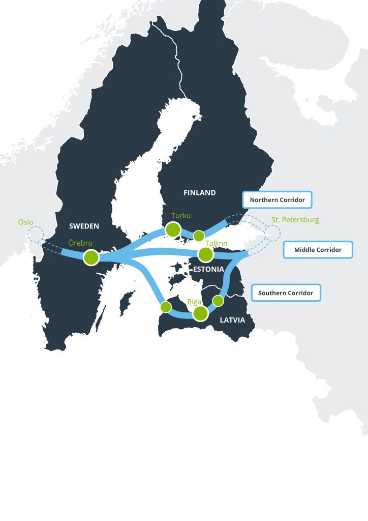
“The transportation corridor should be considered within the international scope, and in order for it to function well, it is important that we eliminate local problems, in particular, in Latvia in our case. In this report we identify several directions for improvement related to both searching for mutual cooperation platforms for experts and institutions, as well as a better mobility planning process and continuity of political decisions. Riga metropolis area plays a very significant role in the transportation industry in Latvia, it serves as a backbone of the internal transport movement with a regional airport, ports and railway network,” Rūdolfs Cimdiņš, Head of Riga Planning Region Administration, admits. The report was developed within the framework of the international project Baltic Loop aimed at reducing the travel and cargo transportation time between Riga and important international transportation nodes in Sweden, Finland, Estonia and Russia (St. Petersburg). The report reviews the so called South Loop section in Latvia including Ventspils (further to Sweden, Norway) – Riga – Valmiera (further to Tartu, St. Petersburg).
Figure: Well arranged public transportation system which could provide a substantial solution for traffic jams is an important element of the transportation system.
Within the Baltic Loop project the route in the South corridor is not geographically convenient for Latvia, other corridors provide a shorter route and are therefore more convenient from the point of view of spent time and resources. Accordingly, within the context of Latvia the Baltic Loop corridor should be viewed as a support function for cargo and passenger transportation. Riga metropolis area plays an important role within this context. This needs efficient planning of the public transportation, planning of cargo logistics, cooperation with other players in introduction of multimodal solutions and provision of a robust chain of transportation services, improvement of the transportation and mobility planning capacity for experts in Riga city.
The lack of a common long-term vision, instability of political decisions and scattered responsibilities between various institutions within the industry present yet another important aspect hindering development according to the discussions. This results in the current lack of overall vision of the transport dimensions instead of separate views of roads, railway and ports.
From the perspective of technology development the issue of innovation, cooperation of science and research, where cooperation is not systematic, was reviewed. Systematic cooperation by utilising assistance of the city planning and mobility laboratories could analyse and simulate the processes of development and implementation of relevant technologies and help to evaluate opportunities, risks and other aspects of the potential of various technologies to both policy makers and the industry business. More environmentally friendly transportation presents another challenge for Latvia and this needs solutions not only in the area of private passenger cars. Moreover, this aspect is becoming increasingly important among tourists.
As regards development perspectives for the South transport corridor new opportunities will be provided by the “Rail Baltica” project with new regional stations, overall infrastructure and a parallel “backbone” to the existing Latvian railway network. The accessibility of jobs in Riga will improve, as the railway will provide fast and convenient commuting possibilities.
The Report was developed in cooperation with SIA Ardenis based on interviews with the industry stakeholders and work group discussions.
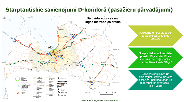
Within the framework of the international project “Baltic Loop”, an online co-creation seminar was held on local level mobility in the Riga metropolitan area and connectivity with the southern transport corridor Ventspils – Riga – Valka.
The aim of the seminar was to discuss the current situation and possible solutions for passenger and freight traffic in the corridor, including the Riga metropolitan area, taking into account the need for connectivity between major development centers (in areas along the corridor) and international multimodal mobility points (Riga port, Riga central railway station, Riga International Airport).
Experts agreed that the backbone of regional mobility for both passenger and freight transport should be rail. In passenger transport, one of the challenges right now is how to create efficient mobility points by transferring from one transport to another. For example, in many places of passenger transport, stations are located far from the administrative center, so it is necessary to create an attractive public transport network that complements each other and ensures a convenient and fast flow of passengers. The integrated public transport ticket is an issue that is on the agenda of various planners in order to reduce the flow of private transport in the center of Riga, but at the same time promote the mobility of the population.
Speaking about the circle of the southern transport corridor Ventspils – Riga – Valka seminar experts have pointed out the need to use the railway infrastructure to Ventspils, resuming passenger traffic. It could possibly be further developed for tourism, offering additional trips by sea.
Regarding the flow of passengers around Riga, the experts pointed out the need to consider better accessibility of the airport in terms of public transport with the center of Riga and further to other settlements in Latvia. At present, this is time-consuming and insufficiently addressed. The Freeport of Riga also has poor connections with the railway and the airport. To get from the port to the airport, you have to drive through the center of Riga.
The participants of the co-creation also emphasized the intention of the Rail Baltica project, which is important in the Baltics, to establish 16 regional stations, which means that local governments must be ready to provide adequate infrastructure for mobility.
With regard to freight transport, the seminar participants emphasized a number of areas to be addressed. One of them is to think around Riga about the establishment of new significant logistics centers, which would also promote business and ease the workload of the center of Riga from the flow of trucks. A good example is the logistics center in Salaspils.
There is no easy solution to the question of how to promote the shift of freight from land to rail, which is more environmentally friendly in terms of harmful emissions. One of the contributing factors was the planned electrification of the railway, which was not in the planned direction Riga – Ventspils.
On January 7, 2021, Vidzeme Planning Region organized a stakeholder meeting to continue the discussion on the vision of the development of the tourism and transport corridor on the Via Hansetica route until 2030. Representatives of the tourism and transport sectors agreed on three strategic development goals for the Via Hanseatica tourism corridor: 1) to improve the speed and efficiency of traffic flow; 2) to develop tourism and mobility information systems; 3) to increase the flow of tourists in the Via Hanseatica tourist corridor. Last December, invited participants met online to discuss a summary of the current situation and to provide ideas for refining and complementing the strategy’s objectives and actions. At the beginning of 2021, industry representatives were gathered to comment on the strategic part of the document.
The strategic part of the draft document formulates the long-term development vision of the tourist route Via Hanseatica for the improvement of passenger flow, strategic goals and development priorities. In addition, directions for action and long-term actions to achieve the strategic goals are outlined.
Given that the quality of the traffic system is crucial for the economic development of the area, the participants of the meeting agreed that the area needs traffic improvements in order to be able to compete at the national and international level. Significant changes can be made by improving both the transport infrastructure and the quality of public transport services, including a strong focus on convenient connections. It is important to be able to use different modes of transport, i.e. for the first and last mile, balancing the offer and possibilities of traditional and relatively new mobility solutions in the area of influence of the Via Hanseatica.
It should be noted that the necessary improvements are important for both visitors and residents of the territory – therefore an integrated approach has been used in defining goals and actions, ensuring high quality of services for both interconnected user groups in the long run.
We remind you that the aim of developing the strategic document is to find out the necessary improvements of transport infrastructure, services and information to ensure more convenient and efficient flow of passengers (mainly tourists) on the Via Hanseatica tourist route, promoting tourism development in Vidzeme planning region.
The vision for the development of the Via Hanseatica tourism route has been developed on the basis of an analysis of the current situation, in which transport industry experts, tourism industry experts and entrepreneurs, representatives of Via Hanseatica municipalities, as well as passenger carriers were interviewed. Passenger and tourist flows were also analyzed, the condition of infrastructure and the quality of services were assessed.
The document, which soon will be completed, will serve as guidelines for the development of the specific territory, and it will be used in their work by municipal specialists, for example, when working with territorial development planning documents, and entrepreneurs planning new services in the territory of Via Hanseatica.
This website uses cookies so that we can provide you with the best user experience possible. Cookie information is stored in your browser and performs functions such as recognising you when you return to our website and helping our team to understand which sections of the website you find most interesting and useful.
Strictly Necessary Cookies
Strictly Necessary Cookie should be enabled at all times so that we can save your preferences for cookie settings.
If you disable this cookie, we will not be able to save your preferences. This means that every time you visit this website you will need to enable or disable cookies again.